Tuesday, August 30, 2011

Sampling Grass - Environmental History on the Chilkoot #2

Looking north from the pass in the morning we followed our trail along Crater Lake and saw, just below the sharp peak, thick clouds swirling through the Notch. We were glad that part of the trip was behind us. However, we had little time for dreaming and set to work. Christine, a long time patrol warden, was our guide and she sent us to places where we might find interesting grasses. We started in the remains of a small cabin, possibly the Northwest Mounted Police post established in the pass during the gold rush. Raf, our ecologist, eagerly and carefully entered the remains and began sampling the vegetation.

Grass is notorious difficult to accurately identify and it is important to catch it during its seed phase. Unfortunately, even in mid-August, it is still spring at the summit and while everything is flourishing the seeds have not yet formed on the grass. Nevertheless we find samples of the same grass later in the week at lower elevations where summer is advanced and they are seeding. It is one of the wonders of the trail that walking is not only about distance, you also move through the seasons as you cross the pass.

Although it is early for grass, much of the snow is gone and we can see some of the well preserved old tins from the gold rush.
At the end of each day Raf enters his samples into the plant press and carefully notes location, type and additional notes on the grasses. At the Chilkoot Pass we enjoy the comfort of the Warden shelter, but in other locations more rustic adaptions to field conditions are necessary. Even in more trying circumstances Raf retains his smile and good humour.


In addition to her duties as historian Karen also took on then logistic responsibilities, preparing our grocery list, making sure it was purchased and sent by helicopter to the Pass earlier in the summer. And at the summit she also takes on the mantle of chef. I like washing dishes on the trail myself, sometimes its the only chance to wash your hands in warm water.

Yumm!. Sausage stew with dumplings.

After two days at the Pass we begin moving down the trail to sample other sites. Near Crater Lake we visit the site of a transfer station where there was a blacksmith shop and what seems to be stables and accommodation for teamsters. Interestingly while the grasses appear to be local species, and not imported volunteer hay as I supposed, they are largely confined to sites that were disturbed during the gold rush. The association between vegetation and cultural activity seems strong and we are pleased to begin thinking about how this might work.
Christine and Rick, Karen's Dad and ecological scientist volunteer, probably talking about grass.
The Crater Lake transfer point site. The Chilkoot Pass visible as the dip in the horizon above.

Rick and Raf doing a grass count.
At Happy Camp we awake in fog again but the wild flowers continue to draw us back to the pleasures of our field work. We head north through the canyon where our party splits. Christine and Raf ford the river to visit the Long Lake encampment while Rick, Karen and I hike over the Long Lake ridge to do a preliminary survey of horse sites near Deep Lake. As the morning advances the clouds breakup and we have warm sunshine for the first time on the trip.
 
Leaving the clouds and damp cold of the Pass behind.
Raf, at first hesitant, expresses his happiness as he makes it across the river ford without getting his boots wet thanks to Christine's magic plastic bags and plenty of duct tape.
The trail north. Another day and we'll be in Lindeman. There is a shower at Lindeman.

Thursday, August 25, 2011

Hiking the Notch - Environmental History on the Chilkoot Trail #1


I've organized a research team to test a possible environmental history project on the Chilkoot Trail. We are interested to looking at how grasses might have responded to the shock of the gold rush stampede of a century ago. Can vegetation patterns tell us something different than the artifact scatter along the trail. Two members of the team are hiking the trail from Dyea and the ecologist and I will meet them at the Chilkoot Pass summit. We will take the shortcut through “the notch” from the highway in the next valley.


I'd done the notch about ten years earlier and vaguely remembered a sunny passage. This trip was different with low clouds and strong south winds blowing in mist, rain and snow. We started in the sheltered by spruce with both sides of the track thick with ripening blueberries. Clearly the berries are being enjoyed as we walk around the regular and closely distributed blue-tinted signs of bear digestion. Happily our morning passage includes only these, the bears must be off sleeping in the bushes.


At Fraser Lake, we stop to admire the rich patches of high alpine flowers – white grass of parnassus, deep blue gentian and monkshood, red dwarf fireweed, purple saxifrage and yellow arnica and higher up white stika burnet with its catkin like blossoms. Along the rushing water courses we cross as we traverse the steep slopes around the lake we also encounter the delicate purple blossoms of moss campion.


As we clamber over the loose rock scree we are surprised to see a tent on the far shore. On approach, heralded by the loud whistles of unseen marmots further up the mountain side, we meet some friends from Whitehorse. They are relaxing under a small tarp sheltering from the rain which has now started and will accompany us most of the way to the top of the notch. After a short visit we continue along the low wet meadow where we cross and recross the braided creek's meanderings. Our boots gradually fill with water. By the time we clear the meadow onto the higher stoney ground the rain has bulked up the stream and we can longer cross. We follow the windings which takes us below the hanging glacier chilling the valley. By now we've climbed a steep 300 metres in seven kilometres. As we round the last corner we see the saddle just ahead and still another 150 metres above us.


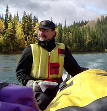
The author glissades Photo: R. Otfinowski
 At the saddle there is snow driven by a 40 km/hr wind blasting us and stripping away our body heat. We scramble across the ice and weather shattered rock core of the mountain seeking the shelter of the lee slope. Through thick fog ahead, we catch glimpses of Crater Lake and the trail far below. We must drop almost 400 metres in less than a kilometre to reach the trail south to the pass. We do not linger but strike for the long finger of snow just below us. A quick glissade takes us 200 metres downhill, it is the fastest we've moved all day. At the end of the snow we laugh with exhilaration and stagger onto the rocks with jelly legs. From here though its loose rocks and sharp edges to the bottom. Finally at the bottom we hike the last hour up to the Summit cabin where we meet our colleagues and begin the process of drying out, warming up and enjoying a hot supper.

Chilkoot Pass patrol cabin

Saturday, August 20, 2011

The Art of a River Journey - Nicole Bauberger Paints


Early morning fog below Selwyn River confluence (2010) Nicole Bauberger
A satisfactory setup
Over the past fifteen years I've become increasingly interested in peoples' understanding of the Yukon River and how they express their connections to it. My own experiences of family canoe trip holidays and work trips researching old wood yards and the riparian ecology have resulted in many personal memories and a large number of photos. I've also worked with First Nation communities learning a bit about their oral tradition and the stories of the Traveler, the creator figure who paddled down the Yukon making the world sensible. And I've enjoyed the art of Yukon painters who've thought about the river. There doesn't seem to be that much river art done from the river so I was very pleased when Nicole Bauberger accepted my invitation for a five day painting trip on the upper Yukon River.

The intimacy of creation - Working up the last painting - Carmacks Bridge
Nicole has been working on an extensive highways series, painting a view every 50 km. The series emphasizes journeys - a starting point, the passage and a destination. To learn more see Nicole's website. On our trip we laugh with Wolfgang Schivelbusch's The Railway Journey where a 19th century French commentator describes Parisians posting themselves to the south of France for a holiday, the speed and isolation of the railway car erasing the journey from their experience. For our river trip we look to consider the journey and its travails and pleasures.

Often we think of a painting as a view of place. As a historian I am always interested in the context and action of the creative process. I am less interested in the mechanics of the creation - I find the actual writing of history a mundane, almost bureaucratic chore compared to research and thinking ideas - but fascinated by the context of the creation. What inspires the artist and what are they looking at. Consequently my photos from the trip largely ignore the painting process, except to note it as a private affair between artist, brush and board. I did take a couple of photos to highlight this sensual intimacy of creation. What I have a lot of photos of though are the artist in a geographical setting. What was Nicole looking at, what was happening around her? It is the context of creation, the forces of place that act upon the artist, that fascinate me. With that I can more deeply appreciate the art itself.

Left click to enlarge - Painting Carmacks
We left from Deep Creek on Lake Laberge in early morning ensuring an easy crossing. At Lower Laberge Nicole began her first painting. By the time we reached Carmacks at week's end she'd completed a series of ten paintings.

The paintings always looked downstream, into the future of our journey. The past was always present around us however. Last summer's forest fire half way through our trip was a stark reminder of the destructive creation that takes place in the boreal forest. There were no sounds or signs of animals or insects. Even so fresh growth was coming up everywhere.

Painting at Hootalinqua
Nicole painted, I read and made notes for a book chapter. Because of the showery weather I also got to play tarp meister and fabricated a number of fantastic rope and anchor architectural pieces.


Representations of place are the critical expressions of the Yukon River cultural landscape. These representations exist as told stories, games played, crafts and land skills exercised, place names, memories and histories written, photos taken and artistic forms created. It was a fascinating experience to watch Nicole's ten paintings form during her journey and I look forward to her showing of these works in the coming months.

For Nicole's view on this trip see her article.

An Arcadian Interlude - Hornby Island

The Gulf Islands off Vancouver Island, the "Mainland" for the locals have been a haven for alternative lives for most of the twentieth century. The relative isolation, rugged beauty and benign climate (at least in the dry summer) have attracted people with dreams for a different life. And even with the large seasonal cottage population this remains true for the permanent residents.


In early July I was invited to a workshop on one of the more remote of these islands. In a sun-dappled maple grove overlooking the Heron Rock beach on Hornby Island a group of students, faculty and local “back to the landers” circled their chairs to discuss the Counterculture and the Environment. The workshop was organized by Colin Coates, an island cottage owner and Canada Research Chair in Cultural Landscapes at Glendon College, York University. The local Heron Rocks Friendship Centre Society, an island group dedicated to the social justice and environmental ideals of its founder Hilary Brown generously hosted us on their lovely property on the garden draped south end of the island. Coates is also acting as editor for a forthcoming edited volume on the topic.


Margaret Sinclair, the island archivist, prepared an exhibit on the Hornby Island counterculture movement and the visitors submitted thirteen draft papers for discussion. Two full days of conversation on the papers considered original counterculture issues such as the fear of co-option by government and an attempt to define when and how the counterculture evidenced concern about the environment. More contemporary issues of defining the bounds of the counter culture – back to the landers, urban activists, utopians – and the object of their countering – industrialism, modernism, social injustice and war – were also addressed. The attending Hornbyites contributed their queries and offered colourful examples of their own experiences which are written into the island landscape they shared with us.

Hornby Island - Central Business District

The workshop was an important and valuable interdisciplinary step in the production of what promises to be a most interesting book. And Hornby Island spun its magic around us all.

Wednesday, August 10, 2011

Summer View from our Bedroom

The Sublime - August Thunderstorm

Last Snow - Early July

August Thunderstorm

Tuesday, August 9, 2011

Twisted Roots - Mather, Manitoba


Southwestern Manitoba was for awhile the home of my mother's family. After escaping from the Soviet Union in 1923 they settled in Gnadenthal, near Winnipeg, where her father purchased a farm. My mother was born there in 1927. With the onset of the Depression however the bank seized the farm for non-payment and the family drifted as economic refugees to less expensive land around Mather.

Mather today is a village with a stark broad main street of metal clad sheds purchased from catalogues. The original typical prairie town of wooden buildings running off the ubiquitous railway line was destroyed in a catastrophic fire in the late 1940s. Only a few charming old houses on well treed lots away from Main street survive from these early days. However the pioneers, and the now long gone railway, are commemorated in the pleasant green downtown.


Dad and I visited Mather to find family traces. We've no idea where the farm was but my Grandfather's grave, with its modest tombstone added by my mother in the 1970s, lies in the cemetery on a low hill a half mile from town.


Heinrich Albrecht married my grandmother in the fall of 1922, just six months after his first wife's dying. The previous five years had been hard with war, revolution and anarchy leading to starvation and destitution for millions in southern Russia and the Ukraine. Heinrich's first wife Aganethe bore five children, only two daughters survived these hard days. Sarah and Heinrich struggled to keep their family together and they left the chaos of a changing Russia for Canada.


After several years as a farmer Heinrich trained as a lay minister for the Mennonite church. Subsequently he traveled widely doing visitations and my grandmother, at home, managed the farm and looked after the by now four children, the older stepdaughters, Gredel and Annie, and her own children Henry (who I'm named after) and Helen (Mum). Their different paths lead to some interesting changes for in the late 1920s the title for the farm and all their property was transferred from Heinrich to Sarah.

Henry and Helen standing by the family horses as they are auctioned off.
The Depression crushed their farm life and was no better in Mather. In 1933 Heinrich died and Sarah sold what they had using the resulting cash to move to Winkler where their family life revolved around the garden, music lessons and school. However, when the money ran out even harder times followed.

An abandoned farmstead near Clearwater, Manitoba


Sunday, August 7, 2011

Working in Skagway

This spring I was invited to Skagway, Alaska to work with the US National Parks Service interpreters of Klondike Gold Rush National Historic Park. The park includes the town of Skagway, a charming restoration of the late 19th century landing point for gold rush stampeders, elements of the White Pass Trail and the start of the Chilkoot Trail, both challenging routes over the coastal mountains to the headwaters of the Yukon River. Although well versed in their part of the gold rush story, the staff were interested in the story Parks Canada tells in Dawson City, the capital of the Klondike gold fields.

They had arranged accommodation for me in the restored Baptist Mission Residence. Located near Skagway Creek with spawning salmon just beginning to run, it was also adjacent to the site of the old Pullen Hotel. The hotel, once the most luxurious place in Skagway during the tourist heydays of the 1920s, is marked now only by the two story stack of cobbles that made up the magnificent fireplace and chimney of the lounge.

The Mission about 1902.
One of the current darlings of Skagway is Sarah Palin. Her family lived in Skagway during Sarah's primary school years and she is a frequent, and popular, visitor in town. One of the town's business men smelled opportunity and opened the Sarah Palin Store. It carries a remarkable array of "tasteful" Palinesque material from her Going Rogue to fridge magnets and coffee mugs.


On my way home I experience another of nature's forces at the summit of the pass. The avalanche happened earlier in the winter but as the snow melts back the devastation and power is obvious.